As we approach the one-month commemoration of the avalanche at Perry’s Peak on Feb. 17, the Truckee/Tahoe community continues to grieve deeply after what is to date the deadliest avalanche in modern California history.
Nine individuals — six women who were part of a friend group on a backcountry skiing trip, and three mountain guides (two men and one woman) — were killed by an avalanche during whiteout winter conditions. All were described as passionate and skilled backcountry skiers.
Many questions remain, the most significant of which centers on why a group of knowledgeable skiers elected to venture out at all, and to take the path they did during dangerous winter conditions and amid an active avalanche warning. While the event itself remains under investigation on a multitude of fronts, with the possibility of lawsuits, enough core information about what took place exists to create a timeline of events.
Moonshine Ink conducted numerous interviews, reviewed reports, and sorted through volumes of information to better understand what happened on that snowy Tuesday in mid-February.
Sunday, Feb. 15, to Monday, Feb. 16
In the days leading up to Sunday, Sierra Avalanche Center forecasters note weak snowpack structures and flag them as “a concern for future storm-loading events,” adding that such layers in the past have contributed to avalanches.
At 6:49 a.m. on Sunday, Feb. 15 — a few short hours before four Blackbird Mountain Guides are scheduled to meet the groups they will guide — the Sierra Avalanche Center issues its first backcountry avalanche watch since Dec. 25, 2025.
“A powerful multi-day winter storm arrives this evening,” notes the report. “Snowfall is forecast to begin tonight and continue for several days.”

Blackbird itself also calls for vigilance. On a social media post the same day, Blackbird guide Jan Czyzewski and founder and guide Zeb Blais post an observation from Mount Rose near Incline Village, saying, “Pay close attention to @savycenter and use extra caution this week!” and referencing a buried, weak, faceted layer in northerly aspects. “This weak layer could lead to some unpredictable avalanches!” reads text on the video. “Typically we’d expect small amounts of faceting between big storms, but with a crust and extended dry period for the month of January into February, faceting has been a driving force in the snowpack.
“The result is a particularly weak layer in many northerly aspects, across various elevation bands. As we move into a large storm cycle this week, pay close attention to places where faceting has been particularly strong — avalanches could behave abnormally, and the hazard could last longer than normal.”
Blackbird’s day-one itinerary for Frog Lake huts trips is to meet at a trailhead off I-80 in the morning, venture to the huts, unpack, and tour the area. “After we’ve had our fill of riding for the day,” the trip-specific website states, “we’ll settle back into the huts and prepare for dinner.”
According to Strava data from Blackbird guide Niki Choo, one of two who guided the group of eight female friends, Choo’s group begins its tour from the Donner Summit SNO-Park. About 4 miles later, after slipping down into the Frog Lake basin via Frog Lake Notch (a steep gully beneath Perry’s Peak), they likely drop gear off at the huts before setting out for another 2.5 mile-loop around Perry’s Peak, back to the notch, and down to the huts.
The following morning, Feb. 16, Choo’s Strava data shows another tour, this one 5 miles long in the Horse Hill area northeast of Frog Lake. While Monday begins the start of a five-day snowstorm that will become the third-snowiest on record, only 2 inches fall on this day, according to OpenSnow.
Horrific conditions, just whiteout conditions. It’s a known area where we have a lot of search and rescue missions — that Castle Peak, Peter Grubb Hut, Frog Lake Hut area — so we train in that area; they knew the terrain. That doesn’t make it easier for them with the snow conditions and wind conditions. What was going through my mind is hopefully they can get there, to the six that were sheltering in place.”
~ Nevada County Sheriff Shannan Moon
Three modern huts are available for booking at Frog Lake, a circular, subalpine lake northwest of Donner Lake by about 3.5 miles, all owned and managed by Truckee Donner Land Trust. In total, 20 guests can sleep across the huts, each of which provides electrical outlets, flushing toilets, hot and cold water, gas stoves, and other amenities.
Serving as the communal space is the Eschenbach Backcountry House, providing a kitchen, fireplace, sitting areas, and map room for planning out recreation options. The Ginger Hut is a renovated summer cabin from before the land trust purchased the site, and is where “hutmeisters” stay to offer a mixture of hospitality and maintenance for guests.
TDLT staff said the majority of reservations are claimed months in advance, with any remaining spots filling in from there.
“[There are] closed periods in the spring and fall for maintenance, admin, and the general challenges of getting there in between [seasons],” said Greyson Howard, communications director for the land trust. “We’ve typically seen both summer and winter over 80% to over 90% occupancy.”
Various guide service options are available, though not required, to reach Frog Lake, particularly helpful for those with “concerns about safety or navigation in visiting the backcountry huts,” as stated on the land trust website, which also lists the following guide options (completely separate from land trust operations): North American Ski Training & Climbing, Alpenglow Expeditions, Alpine Skills International, Tahoe Mountain School, Blackbird Mountain Guides (which offers gear/food porter services), Backcountry Babes, and Dirt Gypsy Adventures (a trailhead shuttle).
Such guiding companies will make reservations for groups just like any guest would.

Tuesday, Feb. 17
The Sierra Avalanche Center (SAC) is one of 14 Forest Service avalanche centers in the U.S.
Forecasting and potentially issuing avalanche watches and warnings starts with daily field work and monitoring the snowpack from the beginning of the winter to late April. SAC observers go out into the forecast area, which comprises 1,500 square miles in the greater Lake Tahoe area, from Yuba Pass on Highway 49 to the north to Ebbetts Pass on Highway 4 in the south. Forecasters observe the weather, the snowpack, and any other signs of instability in the snow.
Next, SAC takes the day’s observations, along with their expertise, and uses a tool called the Conceptional Model of Avalanche Hazard. The CMAH identifies the key components of avalanche hazard and structures them into a systematic, consistent workflow for hazard and risk assessments. There are four sequential questions to answer when assessing avalanche hazard:
- What type of avalanche problem(s) exists?
- Where are these problems located in the terrain?
- How likely is it that an avalanche will occur? and
- How big will the avalanche be?
“From that, we can figure out our avalanche problems and move from there to the North American Public Avalanche Danger Scale,” SAC lead forecaster Brandon Schwartz said.
The NAPADS is a system that rates avalanche danger and provides general travel advice based on the likelihood, size, and distribution of expected avalanches. It consists of five levels, from least to highest amount of danger: 1 (low), 2 (moderate), 3 (considerable), 4 (high), and 5 (extreme). Danger ratings are typically provided for three distinct elevation bands. Although the danger ratings are assigned numerical levels, the danger increases exponentially from one to the next. In other words, the hazard rises dramatically in the higher levels on the scale.
Also factored into SAC’s forecasting is the snowpack history of the season to date combined with what occurred at weather stations overnight, such as wind. SAC works closely with the National Weather Service in Reno. In the afternoon, avalanche forecasters meet to discuss the information gathered that morning and see what other observations come in over the course of the day.
“And then the following morning, the forecaster who was authoring the [forecast] is looking at what happened overnight on weather stations in terms of temperatures, winds, snowfall, looking at cloud cover,” Schwartz said. “And then looking at the day’s weather forecast from the National Weather Service, getting on the phone with them for any clarifying questions, potentially jumping into an online chat with other forecasters to get consensus about any last-minute variables that may be dependent upon the weather forecast, and then moving forward on authoring the day’s avalanche forecast.”
The forecasts are issued by 7 a.m. every morning.
Avalanche watches are issued first, in advance of anticipated storms. Warnings, meanwhile, are issued the same day as dangerous, extreme conditions are occurring or highly likely. Avalanche warnings are pushed out through the National Weather Service on high (4) and extreme (5) days because of its reach to the media, according to Schwartz. If a storm fizzles out or changes direction or intensity, the watch expires and no warning is issued.
“Then the cycle starts over again and we go back in the field, try and get information to verify the day’s forecast, and gather more information to move forward to the next 24-hour cycle,” Schwartz said.
6:29 a.m.
Early the morning of Tuesday, Feb. 17, SAC rates the avalanche danger a 4 at all three elevation levels (above, near, and below treeline). A critical warning, authored by Schwartz, is issued for the Tahoe/Truckee area:
“Travel in, near, or below avalanche terrain is not recommended today. A widespread natural avalanche cycle is expected over the next 24 hours. Large avalanches may run through treed areas. If attempting travel today in non-avalanche terrain, be certain that there are no steeper slopes connected to the terrain you are traveling, either above or to the side.”
An additional line in the avy report reads: “Anticipate that any organized rescue efforts may be significantly delayed or may not occur if you experience a mishap in the backcountry under these conditions.”

During winter, SAC’s daily avalanche report is available to Frog Lake guests. Some told the Ink the report is printed out and posted in the Eschenbach Backcountry House each morning, others said an iPad with internet access is available for guests’ use, and the report is accessible from there.
The Truckee Donner Land Trust lists three winter over-snow routes to reach the Frog Lake huts: from the Castle Peak and Johnson Canyon trailheads, and a Donner Summit Rest Area route. (Based on Choo’s Strava data, the group did not follow any of these trails exactly to reach the huts on day one, though the Donner Summit Rest Area route is closest in alignment.)
No route recommendations are provided to groups by hutmeisters.
At 7:30 a.m., California Highway Patrol – Truckee announces the closure of Interstate 80 to big rigs at Alta eastbound and Nevada stateline westbound. By 11:05 a.m., the freeway is completely closed “due to whiteout conditions and poor visibility.”
Checkout of the huts is by 10 a.m., though based on reporting by the New York Times, the 15 skiers — two touring groups combined into one for the departure — reach the ridge of Perry’s Peak, 500 feet above the huts, around 10 a.m.
“Guests are able to stay at the hut longer in the event of conditions preventing them from leaving,” the land trust shared in an email. “There is emergency food/water available.”
Jim Zellers — a pioneering big-mountain snowboarder and mountaineer who holds first snowboard descents of Mt. McKinley, Mt. Kenya, and New Zealand’s Mt. Cook, among others — has been based in Truckee/Tahoe for most of his adult life.
“I was out [Feb. 17] too,” Zellers said of a backcountry tour he and his wife, Bonnie, went on in Ward Canyon. “It was pretty much a whiteout, so if you were too far from your partner you couldn’t see them.”
He possesses vast backcountry experience in, and knowledge of, the Castle Peak area where the avalanche occurred. He has been to the Frog Lake huts “maybe 40 times,” both stopping in on day trips as well as for multiple-night stays.
“I’ve hiked up exactly where it took place,” he said of the avalanche site. He pointed out its unique and dangerous cross-loaded nature — the snow not exclusively accumulating directly over the ridge and vertically, but from side-to-side as well, adding pressure to the snowpack. “It was a few years ago, we skinned right across it. Bonnie and I got up there and we were like, ‘Whoa, this is a whole cross-loaded slope.’ It’s not super obvious from afar, but when you’re right there in it, you can definitely see it and feel it.”
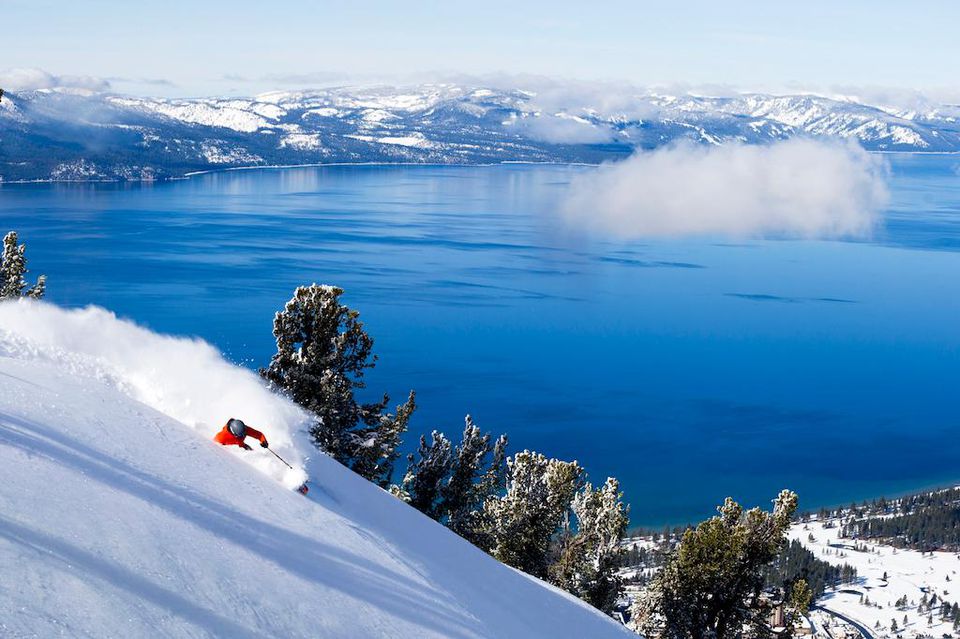
Perry’s Peak is the 8,320-foot-tall peak overlooking the north-northwest side of Frog Lake. The name, not an official U.S. Department of Agriculture-recognized one, is an honorific to Perry Norris, former longtime executive director of the Truckee Donner Land Trust.
Zellers stated that he knows other skiers and riders who have also experienced what he and Bonnie felt that day on the slope, but that it has remained a relatively widely traveled exit path from the huts.
“I love going out that way,” he said. “It’s truly one of the more peaceful, beautiful ways going out.”
Roughly 11 a.m.
As of press deadline, it remains unknown what triggered the Perry’s Peak Avalanche, since ongoing snowfall after the event covered evidence.
What is known is that while the group is passing downslope of Perry’s Peak, close to the Red Dot Trail, the avalanche breaks loose — ending up the length of a football field and 6.5 feet deep, classified as a D2.5 soft-slab slide (a D3 avalanche is powerful enough to destroy a building).
Thirteen members of the 15-person party are caught in the slide, which descends 400 feet from the peak on a 38-degree slope. With terrain traps on the sides, all the snow is funneled into a very narrow area and condensed considerably into a depression, resulting in a debris field in a small box area of less than 30 by 30 feet.
According to New York Times interviews, one buried individual — Anton Auzans — digs himself out and he, along with the two not caught in the avalanche, including Jim Hamilton, unburies others, among them three alive.
Those under the snow have about a 47% chance of survival upon initial burial, according to the American Institute for Avalanche Research & Education. After 10 minutes completely buried, those odds drop significantly.
11:30:58 a.m.
The Times further reported that Auzans is the one who calls 911 dispatch to report the avalanche and that nine or 10 people remain buried.
From there, incident details obtained by Moonshine Ink show the steps taken to maintain communication with the party, coordinate additional responders, and home in on the exact location of the survivors for rescue.
Within five minutes of the 911 call, requests for assistance start rolling out to Cal Fire, Tahoe Nordic Search and Rescue, and Washoe County Sheriff’s Office. Forty-six personnel begin to respond immediately.
The Garmin emergency beacon belonging to one party member’s husband is activated and reported to Placer County Sheriff’s Office.
Between 12 and 1 p.m., incident command (IC) is established at the Alder Creek Adventure Center, about 4 miles away from the avalanche site as the crow flies. Boreal Mountain California (about 3 miles away) serves as the staging area.
“We staged at two areas because we deployed ski teams from two areas — both Alder Creek Adventure Center and Boreal,” shared Nevada County Sheriff’s Office spokeswoman Ashley Quadros in an email. “Reaching the survivors as soon as possible was the goal to prevent further loss of life. IC locations vary by incident and could be at a staging area or at a different location altogether depending on the circumstances at hand. Accessibility and available resources for IC are common factors.”
12:41 p.m.
The party of six survivors stays in contact with dispatch via call, text, and satellite phone. It’s about 20 minutes before 1 p.m. that the surviving guide, who serves as the main point of contact, informs 911 that they’ve moved away from the avalanche debris to a spot among trees.
Snow continues to fall heavily, with low visibility.
Victims are buried beneath between 5 and 8 feet of snow. Per the AIARE, a 6-foot deep burial requires moving at least 10,000 pounds of snow. The survivors also face the threat of another potential avalanche sweeping in from above.
Off the mountain, search and rescue teams are permitted by Caltrans to pass through traffic control on I-80.


3 p.m.
The following is recorded on the incident’s event log by NCSO:
[Search and Rescue] teams are deploying from Boreal as well as from Alder Creek Adventure Center (editor’s note: a Sno-Cat team also launches from Alder Creek). [A unit] is in contact with iPhone emergency services as they are in good satellite text contact with one of the subjects in the field. Advised six subjects are accounted for out of the group. The six are remaining put, one subject advised he was coughing up blood, no other injuries reported.
The subjects advised they cannot pinpoint the location of where subjects are possibly buried due to snowfall.
The six subjects are in the trees at the base of the avalanche and possibly made a makeshift shelter with a yellow tarp.
Also part of this update is the arrival of two Blackbird Mountain Guides members at the incident command center. These two want to deploy into the field but are advised not to. “The guides deployed into the field anyway,” is noted in the log. Blackbird did not respond to Moonshine’s request for comment.


5:36 p.m.
More than six hours after the avalanche, search and rescue makes contact with the survivors. The Sno-Cat team from Alder Creek advances 2 miles, then skis in the remainder of the way.
“Horrific conditions, just whiteout conditions,” Sheriff Moon describes. “It’s a known area where we have a lot of search and rescue missions — that Castle Peak, Peter Grubb Hut, Frog Lake hut area — so we train in that area; they knew the terrain. That doesn’t make it easier for them with the snow conditions and wind conditions. What was going through my mind is hopefully they can get there, to the six that were sheltering in place.”
First aid is administered, eight deceased individuals in total are accounted for, and the group is escorted out back to the Sno-Cat. Two of the six, explains Moon, are not mobile; they cannot walk because of their avalanche injuries. “We were able to safely get them the 2 miles from that location to the Sno-Cat and four others were able to get to the Sno-Cat themselves.”
A little before 11 p.m., Nevada County Sheriff’s Office reports the rescue of six avalanche survivors, and that two of the six have been transported to Tahoe Forest Hospital.
Estimated snowfall calculations for Tuesday at Castle Peak, per OpenSnow: 22 inches.

Wednesday, Feb. 18, to Thursday, Feb. 19
The six survivors have been rescued, but there is still more work to do for responders. They need to safely access the avalanche zone to recover the nine bodies of those killed in the slide — one of whom has not yet been located.
Adding to the complexities, several feet of additional snow have fallen since the avalanche occurred. Thus, the Nevada County Sheriff’s Office, lead agency on the incident, must evaluate the scene and ensure that the area is safe for searchers before sending them back out again. This includes avalanche mitigation.
“We have to reach people before we can help rescue people,” Moon says. “And those decisions are made on-scene by the folks that are going to be getting deployed and making sure they have the right equipment, the right training, and the confidence that they can reach the folks … Last night, I commend them for knowing that they had six people that had survived and they wanted to get there as soon as they could. They took some risks, clearly.
“Today, looking at it, the risk is still as high with the mission moving to a recovery; we want to really make sure that our first responders are safe.”
As of 6:52 a.m. Wednesday morning, the SAC’s avalanche warning remains in place, stating “increased uncertainty exists with ongoing reactivity of these buried weak layers under this large storm snow load. The potential continues for large to very large avalanches occurring in the backcountry today.”
Weather, too, remains a challenge. Placer County Sheriff Wayne Woo says, “Unfortunately we’re kind of at the will of Mother Nature at this point, and going to have to wait for hopefully a decent break in the weather and make sure we get every last soul off that mountain.”
Just after 8:30 a.m., Occupational Safety and Health Administration (OSHA) is notified. When a workplace incident results in a death, or a serious event causes the hospitalization of three or more employees, an immediate, mandatory OSHA investigation is triggered.
At about 11 a.m., Sheriff Moon says Blackbird “has been very cooperative, providing us the individual information from their trip. They also had members arrive at our location when we deployed into the field and they responded with us. They wanted to do everything they could to assist.”
Multiple attempts to deploy helicopters to perform reconnaissance of the incident area, check for travel routes, and search for the remaining individual have failed.
The National Guard and California Highway Patrol are marked as “unable to fly.” Placer County Sheriff’s Office’s Falcon 30 “is unavailable.”
Initially, Care Flight Truckee plans to fly out two observers, but by 3:30 p.m., that reconnaissance is also delayed. Washoe County Sheriff’s Office: unable to fly.
“Due to hazardous weather conditions,” Quadros shares in a press release, “avalanche victims cannot be safely extracted off the mountain today.”
Circa 10 minutes to 4 p.m., the National Air Guard is established as accepting helicopter recon for Friday, Feb. 20.
Thursday morning, the U.S. Forest Service issues a closure on National Forest lands and trails near Castle Peak. The closure is planned through March 15 or until public safety measures are mitigated.
“Due to the current instability of the snowpack and need to prioritize first responder access to the area, members of the public are prohibited from entering the closure area during search and rescue operations,” the announcement says.
OSHA opens its investigation.
In the late afternoon on Thursday, families of six avalanche victims release a statement, which reads in part:
We have many unanswered questions, but here is what we know at this time: Eight close friends planned a professionally guided, two-night backcountry hut trip to Frog Lake huts outside Truckee, California. The trip had been organized well in advance. They were experienced backcountry skiers who deeply respected the mountains. They were trained and prepared for backcountry travel and trusted their professional guides on this trip. They were fully equipped with avalanche safety equipment.
~ From the families of Carrie Atkin, Liz Clabaugh, Danielle Keatley, Kate Morse, Caroline Sekar, Kate Vitt
That evening, Blackbird founder and local Zeb Blais releases a statement that all guides were either trained with American Mountain Guides Association or certified in backcountry skiing, and that each was an instructor with the American Institute for Avalanche Research and Education.
“In addition,” the release stated, “guides in the field are in communication with senior guides at our base, to discuss conditions and routing based upon conditions. There is still a lot that we’re learning about what happened. It’s too soon to draw conclusions, but investigations are underway.”
Friday, Feb. 20, to Saturday, Feb. 21
The UC Berkeley Central Sierra Snow Lab reports that from Feb. 16 to the morning of Friday, Feb. 20, a total of 111 inches of snow have fallen, making it the third-snowiest five-day period on record.
To ensure the safety of search and rescue teams recovering the remaining bodies, the sheriff’s office considers several methods for performing avalanche control leading up to Friday, including use of explosives, according to Quadros. The agency that answers the call in the required timeline is none other than California’s largest utility company.
“Ultimately, PG&E ended up being the quickest viable option,” Quadros wrote in an email.

Friday brings clear skies, meaning flights are a go. First, CHP and Care Flight conduct reconnaissance missions of the Castle Peak area above Frog Lake. On board the Care Flight helicopter are two ski patrollers: Chad Weiland, a Care Flight paramedic and Sugar Bowl patroller, and Ivan McGurk, a Palisades Tahoe patroller and volunteer with Nevada County Sheriff Search and Rescue. McGurk is also a member of the Care Flight Crew Card program, which authorizes specially trained personnel to be transported by Care Flight to incidents such as the Castle Peak avalanche.
The flight lasts about 20 minutes, from 11:19 a.m. to 11:40 a.m.
“We flew to the scene and assessed the slope for avalanche hazards,” Weiland said at the Feb. 20 NCSO press conference. “We circled Perry’s Peak several times and flew into the valley to survey the full avalanche path. The purpose of the flight was to provide aerial visibility of the terrain features and recommendations for appropriate avalanche mitigation.”
Weiland told Moonshine Ink that he and McGurk observed that the slide path was heavily wind loaded.
“We saw the primary avalanche path on that slope, it was north-northwest facing,” he said, explaining that the face gets a lot of wind scouring. “The wind loading was definitely more pronounced than I expected it to be on that slope.”
The Care Flight crew could not see the debris from the avalanche since it was in the trees and it had snowed more since the incident, nor could they see the crown at the top. But Weiland said he was surprised that the avalanche path appeared smaller than he expected it to be.
“It’s a well-known avalanche path, but it’s relatively small,” he said. “It connects to other potential avalanche paths, sort of skiers’ right of that path. The size of the path … almost was undersized for the incident, is how it felt to me.”
Close to 3 p.m., NCSO alerts the public that avalanche mitigation is beginning.
After the recon information is relayed to PG&E, the company flies two of its helicopters — a UH60 Black Hawk and a Bell 407 — from its base at the Red Bluff Airport 36 miles south of Redding to Truckee. The helicopters conduct an overview of the scene before starting PG&E’s unique form of avalanche control — rather than explosives, using buckets of water.
The Black Hawk helicopter is equipped with a 150-foot-long line attached to a Bambi Bucket, which is used to pick up 660 gallons of water from a small, nearby lake that isn’t frozen for a series of seven water drops, resulting in a total of 4,600 gallons of water.
A Bambi Bucket is a lightweight, collapsible, helicopter-slung device used for aerial firefighting, capable of carrying anywhere from 72 to over 2,600 gallons of water.
While these water drops are routinely implemented to fight fires, since 2023 PG&E has also used them for avalanche control at its Helms Pumped Storage Facility located at 8,100 feet in the Sierra National Forest above Fresno.
“Our goal was making the area safe for the search and rescue teams to go in and recover the victims,” said Pete Anderson, PG&E senior manager of helicopter operations, in a press release.
Anderson, who has been with PG&E for 29 years, described this as his proudest moment at the company.
“We played a small part in helping these people get back with their families,” he said.
Using water drops for avalanche mitigation is rare.
“This was the first I’d ever heard of it being used,” said Weiland, a seven-year ski patroller. “It’s really creative, but it’s sort of an unstudied mitigation technique.”
SAC reports that no additional avalanches are triggered by the water drops, making it safe for rescuers to enter the area and retrieve the bodies.
Five of the nine deceased individuals are recovered, and the last body is located.
Nevada County Sheriff’s Office announces its launch of an investigation into whether there is criminal negligence involved with the event.
The following day, Saturday, Feb. 21, the National Guard and CHP recover the last four bodies through a combination of aerial operations and snowcats driven to Frog Lake. The multi-day search-and-rescue effort concludes at 10:58 a.m.
The nine deceased individuals are identified and their information is released to the public:
Andrew Alissandratos (34) of Verdi, Nev.
Carrie Atkin (46) of Soda Springs
Nicole (Niki) Choo (42) of South Lake Tahoe
Lizabeth (Liz) Clabaugh (52) of Boise, Idaho
Michael Henry (30) of Soda Springs
Danielle Keatley (44) of Soda Springs and Larkspur, Calif.
Kate Morse (45) of Soda Springs and Tiburon, Calif.
Caroline Sekar (45) of Soda Springs and San Francisco
Katherine Vitt (43) of Greenbrae, Calif.
Alissandratos, Choo, and Henry were Blackbird Mountain Guides.
The agencies involved with response, rescue, and avalanche mitigation were: Nevada County Sheriff’s Office; Nevada County Sheriff’s Search and Rescue; Placer County Sheriff’s Office; Tahoe Nordic Search and Rescue; Washoe County Sheriff’s Office; Washoe County Search and Rescue; California’s Governor’s Office of Emergency Services; California Highway Patrol Air Operations; Care Flight Truckee, a service of REMSA Health; Pacific Gas & Electric; United States Forest Service; California State Parks; Truckee Fire; OpenSnow; Tahoe Donner’s Alder Creek Adventure Center; Boreal Mountain Ski Resort; Truckee Tahoe Airport; Town of Truckee; Truckee Police Department; Truckee Donner Land Trust; and California National Guard.

Sunday, Feb. 22
A vigil, hosted by the Town of Truckee, is held Sunday evening at 6 p.m. at the eagle statue in Downtown Truckee to commemorate those lost in the avalanche. An estimated 500 people attend.
Monday, Feb. 23
The U.S. Forest Service lifts its closure on all Tahoe National Forest lands and trails in the Castle Peak area.
Friday, Feb. 27
SAC forecasters and search and rescue teams return to the avalanche site. SAR members dig out the victims’ remaining equipment — mostly skis and poles — while the forecasters gather additional data on the terrain.
Ongoing (as of press deadline)
SAC continues to work on the incident report, which will document the details of what the forecasters have named as the Perry’s Peak Avalanche, including contributing factors to the event.
Blackbird Mountain Guides issue a sorrowful statement on the loss of its three guides, and stated it is not accepting new reservations at this time.
The incident remains under investigation through the Nevada County Sheriff’s Office, as well as by OSHA — limiting many individuals in speaking with Moonshine Ink.
“We are looking to determine if there were any factors that would be considered criminal negligence,” Quadros wrote. “It is too early to know if criminal charges will be applicable, as the investigation is preliminary and remains active and ongoing.”