TRUCKEE–TAHOE, Calif. — As the latest storm system moves out of the Tahoe-Truckee region, a brief stretch of sunnier weather is expected — but it won’t last long.
Forecasters say additional snow showers are likely to return over the weekend, continuing an — April pattern that has brought significant late-season snowfall to the Sierra.
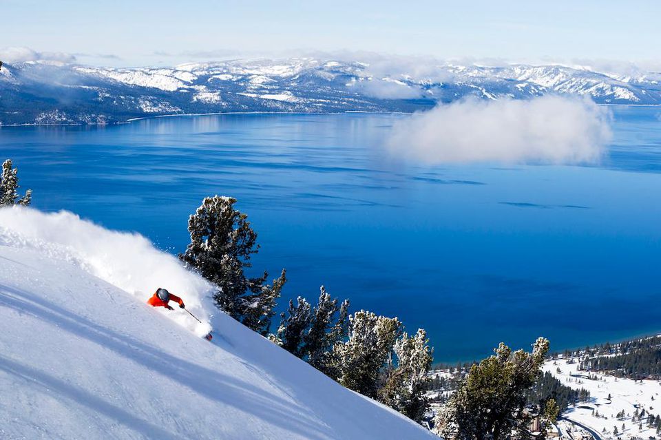
At Palisades Tahoe, officials reported up to 11 inches of new snow from the most recent storm, with totals ranging from 1 to 11 inches between the base and upper mountain. That brings April snowfall to approximately 81 inches so far, and the season total to 359 inches and counting.
“Without March, this was a decent season for snowfall overall,” said OpenSnow forecaster Bryan Allegretto. “March was very warm and dry, and shrunk the base to smaller than it normally would be with 359-plus inches of snow.”
According to Allegretto, skies are expected to clear heading into Thursday and Friday, with mostly sunny conditions across the region. However, some cloud buildup and isolated showers could develop Friday afternoon.
High temperatures are forecast to reach the 50s in lower elevations and 40s in higher elevations.
Weekend brings chance of snow showers
A weak weather system is expected to move through California over the weekend, bringing the potential for scattered afternoon showers.
While the system is not expected to deliver widespread, steady precipitation, forecasters say it could generate consistent afternoon showers.
“This could mean a sneaky snowfall for areas above 6,500 to 7,000 feet, which would impact travel over Sierra passes Saturday night into Sunday morning when temperatures are coldest,” according to the National Weather Service forecast discussion.
Snow levels are expected to start near 7,000 feet before dropping closer to lake level by late Saturday into Sunday. Highs will cool into the 40s for lower elevations and 30s in higher elevations.
Light accumulations are possible on the upper mountain both days, potentially adding up to a few inches by Sunday night.
Unsettled pattern likely to continue
Looking ahead, Allegretto reported that long-range models indicate a persistent trough over the region through at least the end of April, and possibly into early May.
“Without a heat wave, and with clouds and snow showers at times, that should keep the melting slower than it could be.” wrote Allegretto on OpenSnow. “We will have to see if that will allow operations to continue beyond the 1st weekend in May.”