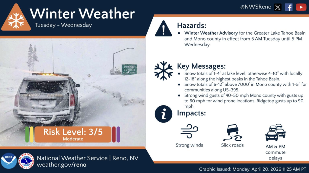
TRUCKEE/TAHOE, Calif. – With a forecasted storm moving into the Tahoe Basin, the National Weather Service has issued a Winter Weather Advisory for the greater Lake Tahoe region from 5 a.m. Tuesday until 5 p.m. Wednesday.
According to the NWS, 1–4 inches of snow are expected at lake level, with 12–18 inches possible along the highest peaks in the Tahoe Basin. The system is also expected to bring strong winds and slick road conditions.
OpenSnow forecaster Bryan Allegretto agrees, noting that rain and snow will be slow to move up the mountains Monday night but could reach Donner Pass after midnight into early Tuesday morning.
He expects snow levels to start around 7,000 feet Tuesday morning, then drop to as low as 4,000–5,000 feet by Tuesday before rising again to around 6,000 feet on Wednesday.
“A drier pattern is likely beyond the 22nd, but showers are possible at times through the end of April into early May,” Allegretto wrote on OpenSnow.